Private fund

Piazza dei Navigatori

SUSTAINABILITY

Piazza dei Navigatori

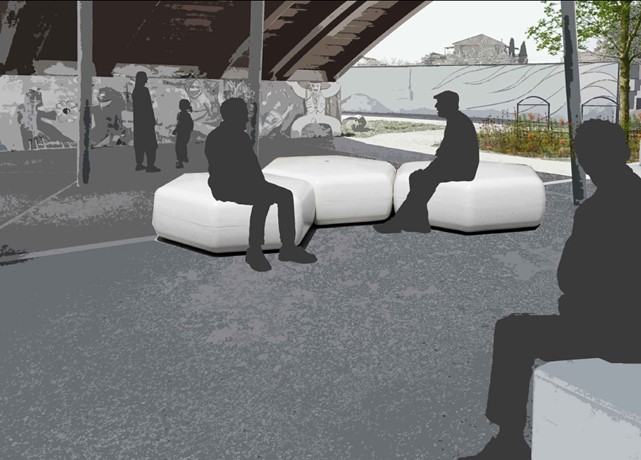
The Innovation Urban Planning has redefined the functionality of public spaces and, simultaneously, implemented a major private intervention designed by "Mario Cucinella Architects". The intervention aims to redevelop the urban area, with special attention to the landscaping of the edges of Via Cristoforo Colombo and the areas connecting with the surrounding neighbourhood. The main goal is to expand this redevelopment to the Plan of Viale Giustiniano Imperatore by reorganising the rest and green areas. This intervention will involve significant simplifications in the local infrastructures, i.e. the reintegration of traffic in Via Cristoforo Colombo towards Viale di Tor Marancia, to allow a full light synchronisation along Via Cristoforo Colombo.

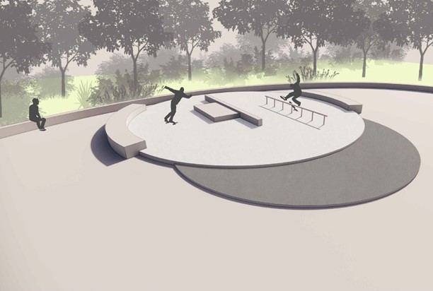
The affected areas will not only benefit from a functional urban redesign, but also from a redevelopment of their public green spaces and urban services, with the aim of increasing the permeability of the area involved and promoting "urban forestation". More specifically, car parks are planned over an area of 39,000 sqm, and green public services over an area of 16,000 sqm. In addition, the cycle paths will be redesigned and new facilities for the neighbourhood created, including a new bowls club, skate park and children's play area. These facilities will be integrated and organised in valuable landscapes, providing comfortable shady spaces.

Lastly, it is planned to relocate the bar kiosk currently located in Piazza Elio Rufino, to create a social context integrated with the square itself, through redevelopment including seats, flowerbeds and potted trees.

Private fund

Render Student Housing

SUSTAINABILITY

Student Housing (Ostiense)

The intervention relates to the construction of a new building of approximately 13,000 sqm in the Ostiense neighbourhood. The area under intervention, denominated “C4 Division”, falls within the area affected by the redevelopment of the Ostiense station, included in the Roma Capitale's Program pursuant to Law No. 396/90.

The building will have a dual purpose, both residential and tourism, for a total of 314 rooms for students and 117 housing units.

The intervention aims to allocate about 435 sqm for social housing. The social housing units have been integrated into the main project and will include one 68 sqm housing unit, six 45 smq housing units and three 32 sqm housing units.

The design of the building emphasises the contrast between the lightness of the metal elements and the material "mass" of the Tower, characterised by windows alternating with shatters or sunshades. 

The whole structure is designed to minimise energy consumption and will include a technical pergola with state-of-the-art photovoltaic panels on the roof and along the south-facing wall. The overall strategy of intervention is inspired by environmental sustainability, with the aim to receive the Leed Gold certification.

Private fund

Render Via Boncompagni

SUSTAINABILITY

Urban regeneration of Via Boncompagni


The Boncompagni project represents the first intervention of multi-purpose urban regeneration in the heart of the Central Business District of Rome. The activity will include four main elements: 

  • a modern office building of approximately 17,000 square metres, situated along Via Boncompagni and Via Romagna, characterised by a contemporary glass façade, a double-height entrance lobby, terraces, and exclusive services and commercial premises;
  • the redevelopment of an existing building of approximately 4,200 square metres, intended for office spaces, with particular attention to the conservation and valorisation of the historical façade along Via Sicilia;
  • a high-standard residential building of approximately 7,500 square metres, located on the corner between Via Boncompagni and Via Puglie;
  • a multifunctional space inside the Church of Saint Lawrence, located on the corner between Via Sicilia and Via Puglie.

The most iconic building, called the Glass Building, will feature a curved glass façade designed by Mad, which will guarantee abundant natural light and transparency to the premises. The building will be able to accommodate up to 1,600 people in modern and efficient offices, in compliance with the best international sustainability standards.

The second building, known as the Brick Building, is characterised by a strong historical identity given by the brick façade on Via Sicilia. Despite having smaller dimensions than the Glass Building, its design has achieved the same level of certifications. 

The residential building will host 38 apartments of different types, characterised by a modern and functional design.

Consorzio Tormarancio

Sostenibilità

SUSTAINABILITY

Tor Marancia Park

The Administration has set itself the objective of completing the enhancement of the Tor Marancia Park in Municipality VIII, a large green area safeguarded by the overbuilding of Antonio Cederna, but still not completely accessible to the whole city. In May 2022, the Council ratified a resolution for the opening of the Tor Marancia Park, defining the agreements with the Tormarancio Consortium to make the green area accessible to the public, regulate the loan of the areas not yet sold to Rome, and manage maintenance activities.

After more than 10 years of waiting, a new segment of the park was inaugurated in August 2022, called Functional Implementation Area (AFA) 3, covering 13 hectares mainly dedicated to younger people, with play areas and suitable paths. In July 2023, the building permit was issued to equip a further 6.5 hectares of greenery, including an equipped garden, a paved square of approximately 700 m2, bicycle-pedestrian paths, a fitness trail, an area for children, and an area for dogs. Work is underway and is expected to be completed in spring 2024. At the same time, work is underway to start the recovery of the 3 farmhouses, so-called AFA6, located right inside this portion of the park. Currently, the decision-making services conference is underway and is expected to end by early January 2024.

Roma Capitale
Render Villa Aldobrandini

SUSTAINABILITY

Redevelopment of Villa Aldobrandini

The redevelopment of Villa Aldobrandini is a complex challenge that touches on environmental, architectural, historical, artistic, urban, social, and management aspects, all linked to its accessibility. The preliminary project for the general recovery of the Villa, with an estimated cost of € 8,300,000.00, was approved by Resolution of the City Council of Roma Capitale no. 98 of 30 March 2023. This project includes six areas of intervention:

  • vegetation recovery and redevelopment of the garden;
  • recovery of the pavilion on the corner between Via Nazionale and Via Mazzarino;
  • recovery of the pavilion on the corner between Via Nazionale and Largo Magnanapoli;
  • restoration and recovery of the Sixteenth-century loggia, original access to the villa;
  • restoration of the staircase and adaptation with elevator from the Nineteenth-century portal overlooking Via Nazionale;
  • renovation and redevelopment of the archaeological area.

With an initial funding of € 2,700,000.00, the executive project of the first batch was drawn up, whose work began on 11 April 2024. This first phase includes:

  • vegetation recovery and redevelopment of the garden;
  • recovery of the pavilion on the corner between Via Nazionale and Largo Magnanapoli, intended for use as a coffee house and installation of an elevator connecting to the garden;
  • restoration and recovery of the Sixteenth-century loggia, original access to the villa, with museum accommodation and recovery of the cordonata.
Roma Capitale
GRAB

SUSTAINABILITY

GRAB (Grande Raccordo Anulare delle Bici - Great Ring Road for Bicycles)

The GRAB project is a cycle path designed by associations of cyclists and environmentalists with the aim of promoting tourism and enhancing landscape and historical, artistic and environmental heritage. The ring road is around 50 km long, formed of pre-existing stretches of cycle paths along roads and in parks, as well as new routes built specifically for this purpose.

The project has already been added to the national system of tourist cycleways, granting it significant public relevance. Its implementation falls under the measures of Italy’s National Recovery and Resilience Plan (NRRP) and is one of the projects related to the Catholic Church Jubilee celebration in 2025.

The GRAB crosses the most significant locations in Rome, from centre to outskirts. Divided into 6 lots, each one divided again into smaller sections, the route touches down in iconic locations such as the Colosseum, Palatine Hill, the Baths of Caracalla, the old Appian Way, the Quadraro neighbourhood, the Valle dell’Aniene Nature Reserve, Villa Ada, Villa Borghese Gardens, Via Guido Reni, Viale Angelico, Via Lepanto, Via Giulia, and Via dei Fori Imperiali.

The project activities aim to ensure the usability, interconnection and intermodal nature of the route, while respecting Directive 375/2017 of the Ministry of Infrastructure and Transport (MIT). This means the Rome Cycleway is key infrastructure for promoting sustainable mobility and health. Its construction offers an opportunity to transform and develop strategic areas of the city, rethinking the roles and shapes of its major roads.

The Cycleway becomes an integral part of this transformation, positively influencing the quality of urban spaces. By connecting places of excellence and daily function, the infrastructure is rooted into the territories it crosses, becoming a trajectory of encounters and a valid alternative to the use of cars for daily journeys.

The creation of connections with rail stations is crucial for extending the GRAB radius of use. The cycleway intersects 8 metro stations, 13 stops on 6 different tram lines, and 3 railway stations. This also makes the GRAB accessible from the rail, metro and tram networks, expanding its use beyond municipal borders.

Approved in December 2023, the final design eliminates interferences with jubilee projects and NRRP measures, guaranteeing the cohesion of the GRAB with the Catholic Church Jubilee celebrations and urban planning objectives (PUMS – PGTU). The Cycleway is the key in a new vision of urban mobility, contributing to lower pollution and social costs and fairer access to resources in the territory.

Along its route through the city, from the center to the outskirts, the GRAB takes on different characteristics and forms: in some sections, it is a clearly defined path, separate from pedestrian walkways, while in others, it runs along sidewalks, integrating with the road. In the green areas of villas and parks, the route follows existing paths, which are undergoing restoration to repair original paving and drainage systems, with the goal of ensuring safety and decorum. During the services conference, the Colosseum Archaeological Park requested, for Lot 1, a shared decision-making process regarding the "green band" and the planting of specific plant species along Via di San Gregorio.

Working site considered partially closed and operating at the beginning of the Jubilee Year.

Private Fund

Render ex Residence Bravetta

SUSTAINABILITY

Former Bravetta Residence

The former Residence in via Bravetta, a structure of approximately 100,000 m3 built in the late 1970s, remained in a state of abandonment for over 15 years, configuring itself as a reinforced concrete structure at the entrance to the Valle dei Casali Nature Reserve. 

Following the eviction of the last building, which took place in August 2007, the buildings were stripped of their external walls to avoid occupations, awaiting reclamation and redevelopment.

Demolition operations on the first building began in July 2022 and were completed in spring 2023. Demolition of the second section, consisting of 4 buildings, began in November 2023 and will be completed in spring 2024.

In accordance with a 2022 council resolution and the subsequent supplementary agreement signed in May 2023, a new children's centre will be built in the area of the former Residence, including a kindergarten and a nursery school with a maximum reception capacity of 150 children. Public squares and paths will also be developed between the "Buon Pastore" complex and the park itself, facilitating the direct connection of the neighbourhood with the surrounding urban park system: "Valle dei Casali", "Tenuta dei Massimi" and "Villa Pamphilj".

Zetema
Cultura

CULTURE

Unexpected Itineraries of Rome

The “Unexpected Itineraries of Rome” project is a chance to develop, promote, communicate and make available itineraries beyond the usual tourist routes, focusing on decentralised areas of the city characterised by notable elements of nature and landscape, and archaeological sites of great historical, cultural and artistic importance. These zones, while rich in beauty and uniqueness, often go unnoticed even by local residents.

The main goal of the project is to counter the phenomenon of overtourism, namely, the excessive numbers of visitors in restricted areas, concentrated in Rome’s case in the historic centre. To achieve this goal, the intention is to promote valuable experiences in places outside of the current traditional tourist itineraries. At the same time, the aim is to create a philosophy called “never-ending Rome”, with the intention to encourage repeated journeys, targeting tourists of all ages who have already visited the city (repeaters), as well as a prevalently young market.

Through this initiative, the hope is to create a new perspective on discovering the city, helping to distribute the flow of tourists in a fairer and more sustainable way, preventing the excessive saturation of the historic centre and encouraging exploration of less frequented places but with great cultural value.

7 itineraries identified:

  1. Martyr’s Park of Forte Bravetta
  2. Villa Statilia Park, Piazza Vittorio Gardens, former Roman Aquarium
  3. Gazometro and Caffarella Park – the Almone River Itinerary
  4. Torre del Fiscale Park and Park of the Aqueducts, with street art in the Quadraro neighbourhood
  5. Parco di Tor Marancia and Tor Marancia neighbourhood with street art
  6. Pantano and city of Gabii
  7. San Vittorino and city of Gabii

Digital Realty

Render panoramico Data Center Digital Realty Testuggini

INNOVATION

Data Centre Digital Realty Via delle Testuggini - Trigoria

The Roma Capitale Council has approved the Reuse Plan of the former ACEA Management Centre, located on Via delle Testuggini in Rome Municipality IX, for transformation into a Data Centre. The project involves building a facility on an area of more than 150,000 square meters, which will include green spaces of more than 24,000 square meters and a pedestrian plaza of 14,000 square meters. The road system will also be adjusted, and more than 12,000 square meters of parking spaces will be built.

Conversion of the brownfield site will take place through partial renovation of existing buildings and limited reuse of the Gross Usable Area (GLA) for new facilities, without increasing cubage or further impacting the landscape. The intervention aims to redevelop the area, improve the existing technological infrastructure and enhance the surrounding environment. The new Data Centre will contribute significantly to job creation, both during the construction phase and in the operation of the centre, generating positive fiscal and economic impacts.

The creation of European-level digital infrastructure, through the conversion of disused sites such as the Acea Management Centre, not only promotes the city's urban development but also economic and employment growth. Such centres also increase the attractiveness of the city, making it more beneficial to major investment.

Roma Capitale
Render Piazza Venezia Vista aerea superficie

SUSTAINABILITY

Metro C: Piazza Venezia stop

Line C, Rome's third subway under the new Town General Plan, will directly connect distant areas by crossing the city from northwest to southeast, so greatly extending the existing metro network. The current route, which is 25.5 km long and includes 30 stations, begins in the municipality of Monte Compatri, follows the Termini-Pantano railway, crosses underground just before the Grande Raccordo Anulare and heads into the historic centre to the Mazzini district, keeping about 30 m above street level.

The route is divided into various sections: T2 under design, T3 under construction, T4-T5, T6 and T7 with the Granite Depot already operational. This division results from functional reasons, design needs, approvals and funding. T2 section will include a functional sub-section: the Venezia-Colosseum/Imperial Fora section, which will extend beyond the end of Section T3 for about 250 m. It includes the Venezia Station, the fire station shaft and railway communication between odd and even track. The final design of the Venezia-Imperial Fora sub-section, including the Venezia Station, was submitted to the Conference of Services in July 2021, including the positive outcome of the verification of compliance with VIA (EIA) requirements.

The financing of the total amount of € 755,000,000.00 is ensured for € 145,000,000.00 by Decree Law No. 133 of 12 September 2014, coordinated with Conversion Law No. 164 of 11 November 2014, and for € 610,000,000.00 by the resources referred to in paragraph 393 of Article 1 of Law No. 234 of 30 December 2021 (Budget Law 2022) allocated by Interministerial Decree No. 97 of 20 April 2022.

The final design of T2 Section Venezia-Imperial Fora/Colosseum sub-section was approved by Order No. 3 of 30 December 2022 prot.l79/M of the Extraordinary Commissioner. By Service Order No. 35 of 17/01/2023, the Sole Project Manager (RUP) ordered the start of the executive design activities, based on the approved final design drawings, taking into account the requirements attached to the Technical Verification Minutes, and subjected the start of the work to the approval for the three parts of the executive design.

The first part of the executive project of the Venezia-Colosseum/Imperial Fora section was delivered by the General Contractor Metro C S.c.p.A. on 13/02/2023 and 17/02/2023 and was then supplemented with the additional submissions on 18.04.2023.

This was followed by the delivery of the drawings constituting the additional two sections, into which the issuance and approval of the executive project of the sub-section in question was divided.

By Approval Act No. 13/line "C" dated 16/06/2023, the Contracting Authority approved the drafts of the 1st part of the Executive Project. By Approval Act No. 16/line "C" dated 24/07/2023 the Contracting Authority approved the executive project second part of the Venezia-Imperial Fora/Colosseum sub-section and finally by Approval Act No. 1/2024 dated 10/01/2024 the Contracting Authority approved the executive project for the third part.

By Service Order No. 39 formulated by the Project Manager on 26 September 2023, the start of activities took place and excavations on Piazza Venezia are underway, and on 1 October 2023, the Executive Work Program of the section was updated (from 17/01/2023 to 03/09/2033)

As of 30.11.2023 (SAL 2 as of 30/06/2023) there are 2 SALs issued for the T2 Venezia - Colosseum/Imperial Fora sub-section and 2 payment certificates issued for a total certified amount to the credit of the General Contractor of € 13,983,074.43 plus VAT.

The amount corresponds to approximately 2% of the total reference amount from the updated Economic Framework (€ 588,424,487.84).